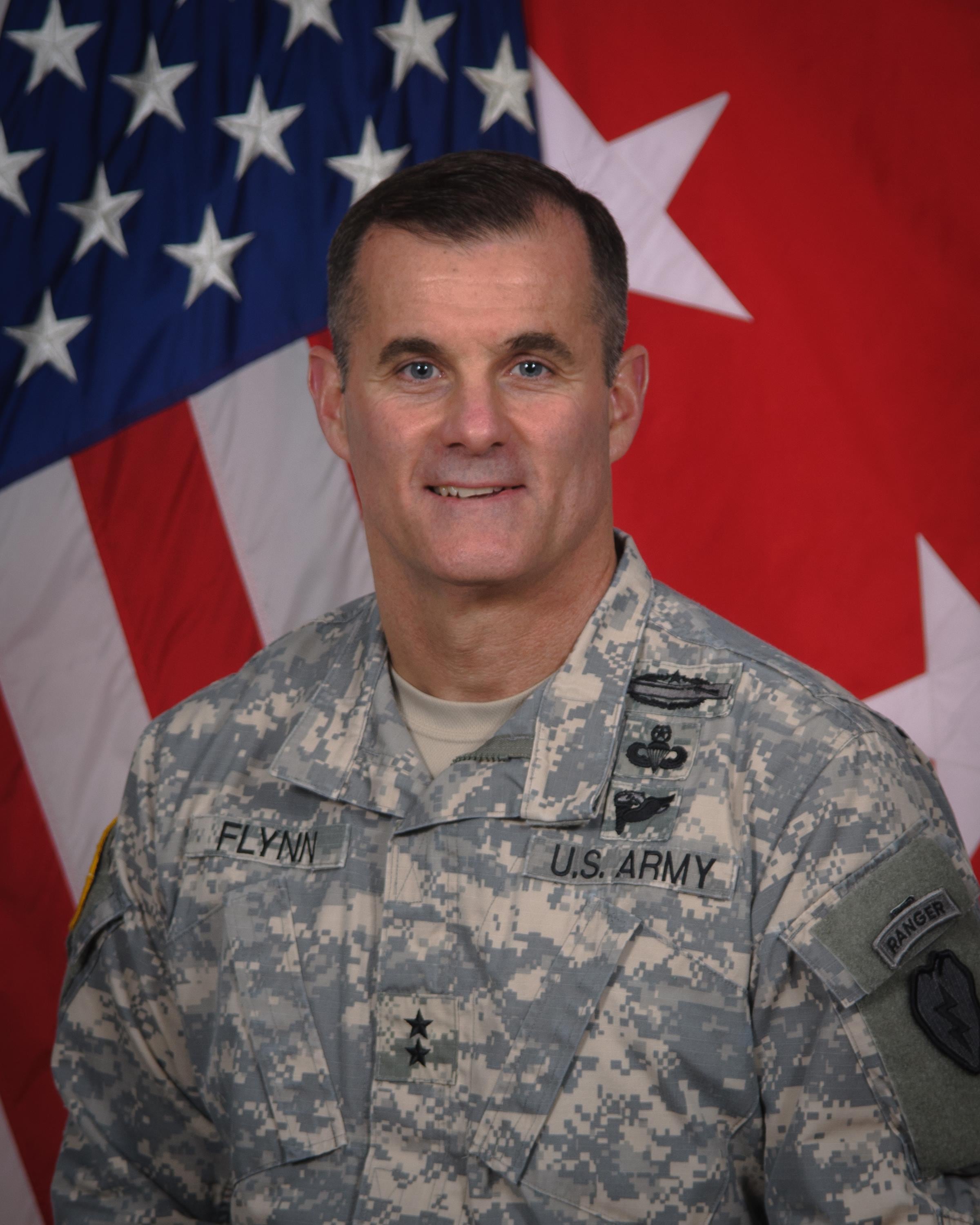
MG Charles Flynn is the commanding general of the 25th Infantry Division in Hawaii. Prior to assuming command of Tropic Lightning in May 2014, he was deputy G3/5/7 for U.S. Army Forces Command, and deputy commanding general of operations of the 82nd Airborne Division, both at Fort Bragg, North Carolina.
He sat down with C4ISR & Networks Editor Barry Rosenberg at his office at Schofield Barracks in central Oahu to discuss expeditionary communications. In addition to being a storied fighting force in the Pacific dating back to World War II, the 25th ID is also called upon for humanitarian relief during disasters such as the typhoon that struck the Philippines in 2014.
To assist in developing the communications and situational awareness necessary to operate in such scenarios, this summer the 25th ID conducted a limited demonstration/integration event to test a variety of expeditionary systems, including 4G LTE, that give dismounted leaders access to intelligence, surveillance and reconnaissance sources, common operational pictures and digital networks necessary to maintain situational awareness.
C4ISRNET: What are the specific communications and situational awareness requirements of the 25th Infantry Division?
MG CHARLES FLYNN: What we have is a combination of our standard Army equipment that brigades, divisions and battalions use every day. It is reliable. We just came out of a combat training center and it works. For sustained land operations, you need those types of equipment. Here in Hawaii, and because of our mission set, and because of the 16 time zones and datelines and the tyranny of distance, you also need some expeditionary kit so you can deploy with it on little to no notice and be able to establish a command post forward pretty quickly to get situational awareness. You then need to be able to report, either voice or digitally or through other surveillance means, to your higher headquarters so you can get an estimate of the situation in terms of what is happening.
C4ISRNET: So where are your gaps in ISR and situational awareness with respect to being an expeditionary force that sometimes must deploy at a moment's notice?
FLYNN: There are certainly tools and kit that we are experimenting with this week [during the limited demonstration/integration event] that when applied to our mission can increase our ability to see and understand the situation better … and again, being able to report back to Hawaii or elsewhere given some of the reaches that we have to get our forces into. Just take, for example, the recent events in Nepal [the earthquake in late April]. Having the ability to get out there quickly with some communications and leaders, to be able to report back what is happening, is part of what we recognize as something that is going to be needed and is needed now in the area that we're operating.
C4ISRNET: And there is an important coalition aspect to sharing information in both humanitarian and combat operations, as well.
FLYNN: There is.

MG Charles Flynn, Commanding General, 25th Infantry Division
Photo Credit: DoD
C4ISRNET: Tell me about the 25th ID's relationship with militaries in Korea, Philippines and Indonesia.
FLYNN: I will not go into specifics. I would just say sharing information in a coalition environment enables trust. If we are not willing to share information with them, then there is always going to be this chasm of trust between the partner nations we are working for or with and our forces. I think having hand-held radios and other pieces of equipment where when we partner with them we can either loan or they can operate on.
What we have found in some of these countries is that they have the same kinds of radios that we have, and if you go to plain text then you can talk. You just have to put the frequency there. A lot of them, while there may be a language barrier, speak English, pretty good English. We are able to then operate with them using radios that they have, radios that we have because we just work through the technical issues, and we can share information together.
C4ISRNET: So right now you have a rudimentary capability to share situational awareness in a coalition environment. How would you like to see that evolve?
FLYNN: I think having a credible coalition network that we could rely on, and which was stable and allowed you access into the data that you were able to work from every day, and then be able to transport that [data] quickly, I think those are the characteristics of something that we would want in the future for our forces to be able to have available at their fingertips, both at home station and then during a deployment.
C4ISRNET: On one hand you're developing expeditionary equipment, and on the other hand there are the programs of record like the Warfighter Information Network-Tactical that also form tactical networks for the Army. Can the less costly expeditionary systems replace the programs of record in some instances?
FLYNN: I do not know if it is an either/or. I think it is a both/or/and. You are going to need both. The program of record equipment that we get is valuable for sustained operations. You have to have some of that stuff because the weather can beat it up. It is durable. Yes, it is big, it is heavy. We may need some other people to help with it by way of contractors. But if you are going to be somewhere like in Korea where we have been for over 60 years, you're going to need something stable to operate on. Or if you are taking a force somewhere for an entire year or two years, you are going to need something that has got a little more durability.
The expeditionary stuff is not built like that. It is not built for the long haul. It is not built for a year deployment. It is built to get in quick, to get up quickly, and then to have a scalable package that you can put on the ground quickly, get it up rapidly and then be able to communicate quickly to get initial reports out, to get situational awareness and understanding up. Then somebody can take what I would say is a relatively chaotic event and create some kind of order from it. I do not think it is an either/or. You need both of them.
C4ISRNET: With the expeditionary systems you're testing, what does it need to show you that it can do?
FLYNN: I think what I would like to see achieved when we are deployed is to have a credible coalition network at the tactical edge that allows us to be able to take forces, put them anywhere in the region, and then be able to build situational understanding, have degrees of awareness by having that force coupled with these capabilities forward, and then be able to report back estimates [and] assessments, and increase the situational awareness and understanding of commanders and other capabilities at the operational and strategic level.
What I was just describing to you is the tactical edge of us being able to do that. When you have to do that across the globe with the reaches that we just talked about, I want to be able to take what we are doing this week here and then go apply it into one of our deployments and say, "We just got it out of concept, just got it out of innovative thought, and it has now been practically applied." It either does work or it does not work, or it works to a degree. And then we can give feedback to industry, our own formation, other leaders and say, "Here are some tweaks that we need to do to make it work better."
C4ISRNET: In conjunction with the land element, you're looking at expeditionary systems such as portable satellite dishes for Army logistics support vessels.
FLYNN: There is a lot of interest in mission command on the move. A lot of that has to do with the tactical edge of forces walking or moving in a vehicle or en route in the air. That has been traditionally in the bailiwick of special operations forces. Here, we have Army vessels that transit the Pacific Ocean. Part of this week was actually to put some kit on those vessels to determine whether we can create a sea en route mission command suite on one of these vessels.
It gives us some situational awareness in the same illustration of what we're trying to achieve with land-based forces at the tactical edge. Because while en route, it would be good to know sea states, rate of advance, location, timing. There is a wide range of capabilities that we can put on those vessels — from helicopters to Stryker vehicles to people and humanitarian assistance such as food and water.
Out here, again, operating in a very unique and complex environment with unique capabilities, that does give us the ability to discover, learn and experiment with some of those capacities that are not widely known across the Army. It gives us a little bit of an edge, if you will.


