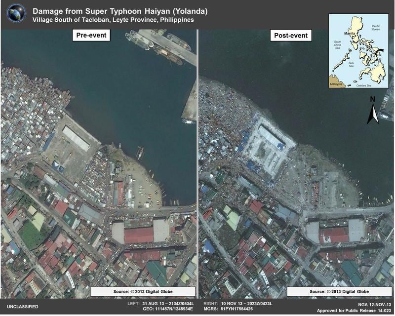
Commercial imagery use by the National Geospatial-Intelligence Agency (NGA) is in the midst of improvements redefining the GEOINT landscape.
Earlier this year the Commerce Department approved the sale of higher-resolution images top the open market with full implementation scheduled for February 2015. In the past, satellite companies could collect at one resolution, but sales had to be made in a lower resolution. The new arrangement creates a single-tier approach.
"Commercial imaging satellites are getting more and more capable as industry advances, and frankly it's really exciting," said John Charles, national geospatial intelligence officer for commercial imagery.
A large proportion of the NGA's imagery comes from commercial sources; organization officials decline to state exact figures for security reasons. Most of that commercial imagery comes from the company DigitalGlobe. This August, the company launched and reached initial operational capability on its WorldView-3 satellite. It has six total satellites in its constellation, which can collect close to 1.5 million square miles of imagery each day.
Over the past year, DigitalGlobe increased the speed at which end users receive imagery and information. Products such as Global Enhanced GEOINT Delivery can supply orthorectified imagery to troops or first responders in a timely manner across multiple classification channels and mobile devices. "Imagery from this service has been delivered as quickly as 11 minutes from time of downlink from the satellite to its availability on our service," Marcy Steinke, senior vice president of government relations for DigitalGlobe, said.
Commercial imagery is important across the government in part because it is unclassified, which allows customers to share it for better situational awareness and faster response in rapidly changing environments.
The NGA also aims to be more responsive to customers across the board. That's the goal of its GEOINT Solutions Marketplace (GSM), an environment designed to connect users, requirements and providers more effectively.
Within the next five years, the U.S. government wants to graph the entire terrestrial land surface on the planet and update it regularly, according to Eileen Preisser, director, Air Force GEOINT Office, and Air Force Geospatial Scientific and Technical Advisor. Commercial products will be imperative to the effort, keeping costs down and adding capability.
"Commercial imagery is a resource that is exploding in the near term," Preisser said. In addition to military and intelligence use, it has applications to the corporate world, which has similar desires to get the right information to the right place.
Preisser said two recent moves by NGA particularly assisted the Air Force. The first move was embracing Web-enabled services. The Air Force is trying to optimize integrated ISR, requiring it to overlay information on geospatial products. The services make commercial GEOINT easier to manipulate. The NGA is focused on improving the utility, quality and accessibility of its products. It recently introduced a Web domain that allows defense and similar clients to download images more quickly in the field. Charles said the NGA is particularly excited about making imagery easy and fast to obtain.
The second move is the negotiation for commercial imagery with the Enhanced View contract. Without that, Preisser said users would lack high-quality and current overhead electro-optical images. If the Air Force had to negotiate on its own, the image quality would be lower.
Other improvements Preisser has seen over the last few years include more infrared capabilities and faster speed to marketplace. "I also think NGA has come a long way with their controlled image base," she said. The controlled image base is employed often overseas, particularly in combat environments. The Air Force sometimes can access the data from the commercial imagery offered via the NGA and pass it to other military branches with less bandwidth and throughput.


